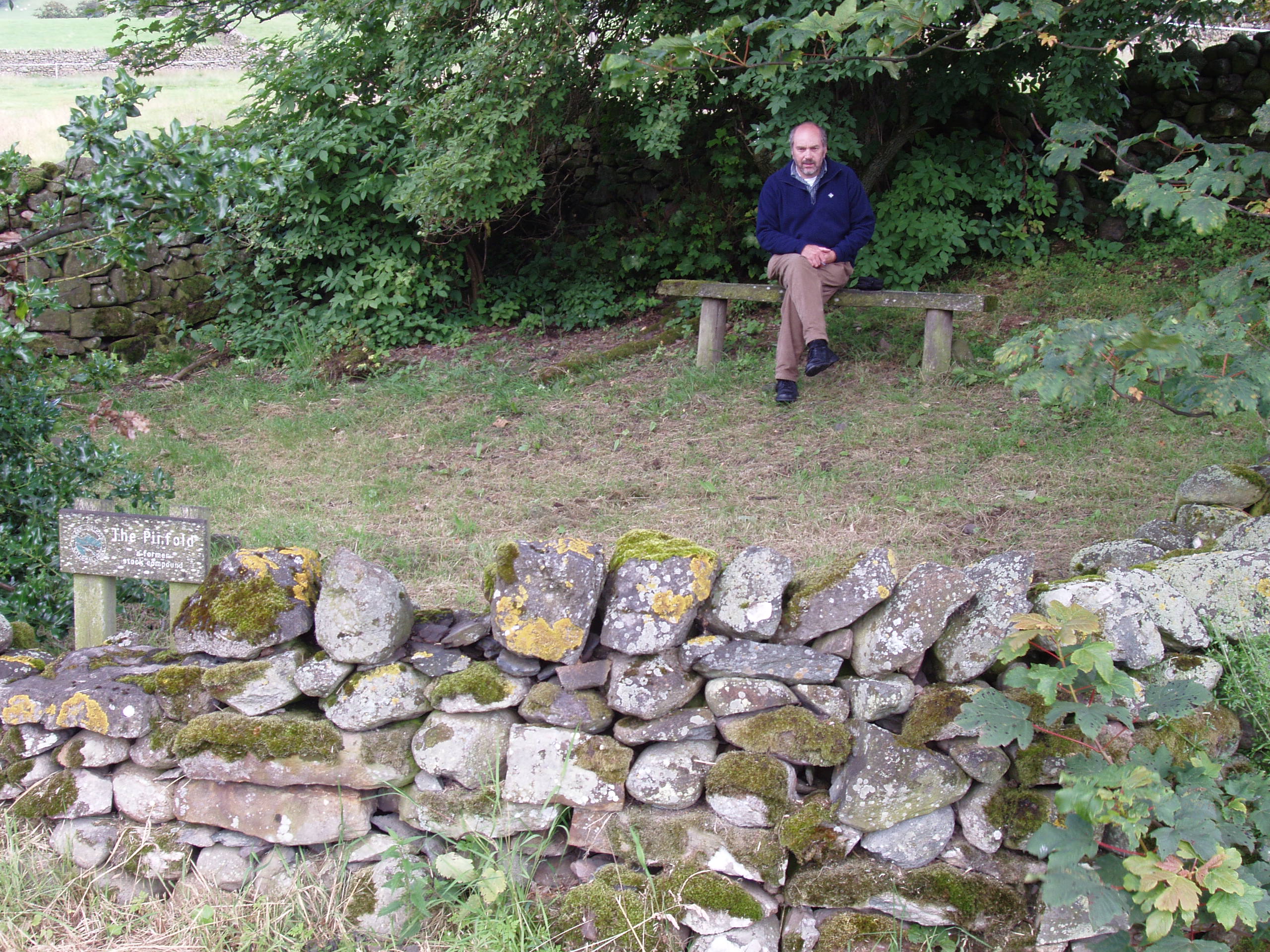
Pounds and Pinfolds
LATEST NEWS.
I have completed my research into the "History and Mystery" of the Pinfolds of Cumbria and have published "Pounds and Pinfolds of Cumbria".
It is described by the publisher as a scholarly and well-researched account which provides a comprehensive and unique insight into a little-considered aspect of our rural heritage and into the way of life of the men and women who farmed our hills in days gone by.
In it I explain the purpose, use and management of pounds and pinfolds from original and secondary sources and have included information on the present state of over 160 sites. I hope this publication will encourage others to investigate sites in their own home counties.
The book may be purchased from me. If you wish a copy please email me nigelmillspp@gmail.com.
News about Grasmere Pinfolds. I will be adding an image or two, for one of the three missing pinfolds, thanks indirectly to the Grasmere Association who plan to repair the one adjacent to the Rothay. I will update the Register entry and book in due course.
Nigel July 2022
This is the Pounds and Pinfolds Register for Cumbria set up to record and encourage the knowledge and preservation of these structures in our landscape.
The locations listed have been identified from maps, archive records and by being observant when travelling around our towns, villages and cities. Minimal information is currently recorded and so I am seeking to expand on this with any information that I recieve from you, the reader, Please send me any information using the email address on the Home Page. Thank you.
Ordnance Survey grid reference X and Y coordinates are given. For a 6 digit grid reference read 317391, 550684 as 173506.
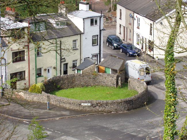
Abbey Town Pound, Wigton. Grid ref: 317391,550684
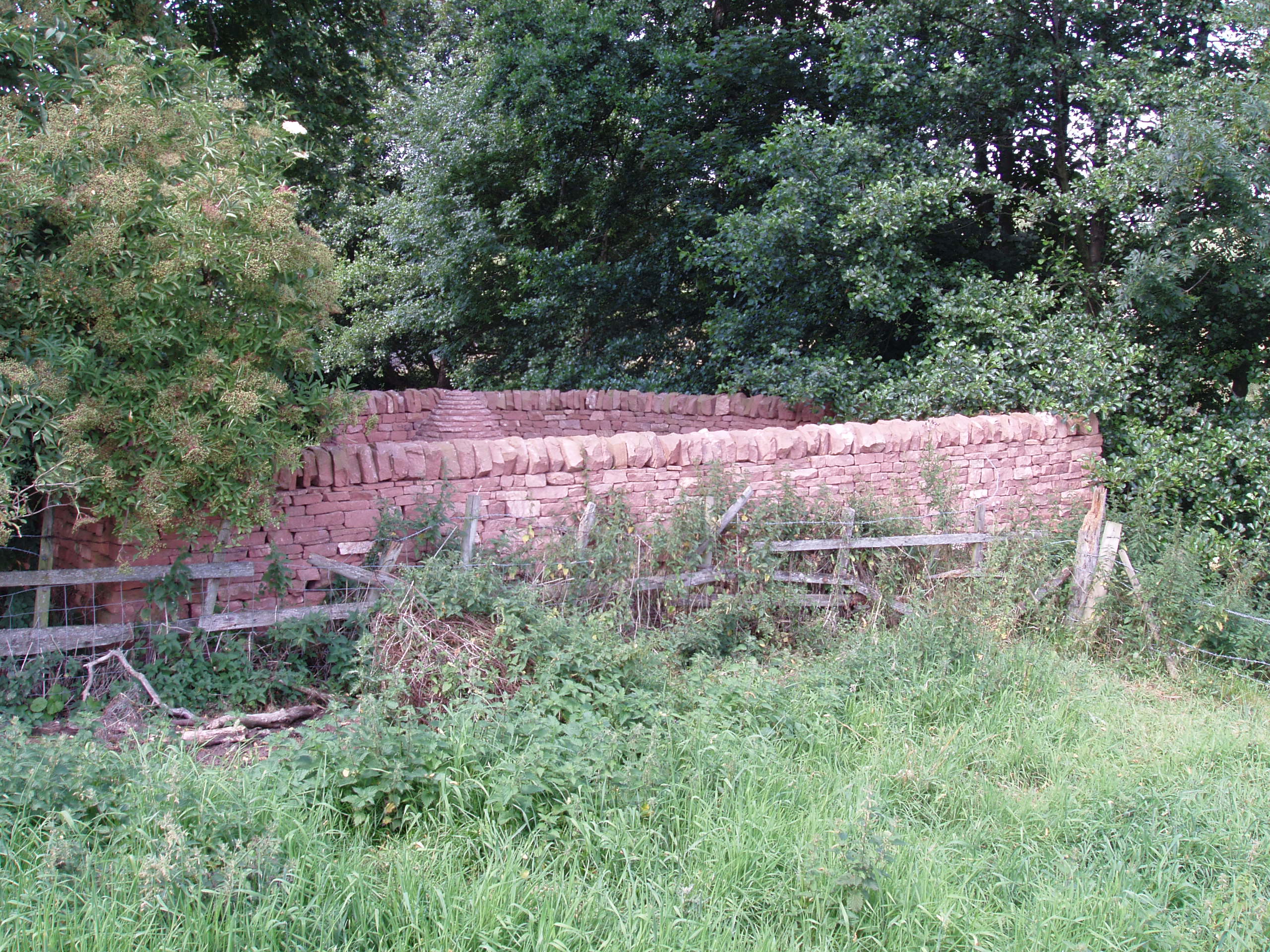
It is located on the left approaching Abbey Town from the south on the B5302, at the far end of a row of terraced houses. This is a stone pound with triangular capping stones and a small iron gate with overhead lintel. In good order, now used as a garden and approx. 10mtrs by 7mtrs. The south corner has been removed and wall rebuilt probably to give rear access to the row of houses. It is shown on the 1866 OS 1:2500 map, as a pound in the corner of a field. No buildings are shown. A date stone on the adjacent row of houses indicates they were built in 1887 and the removal of the south corner of the pinfold probably occurred then.
Ainstable Pinfold, Penrith. No trace. Grid ref: 352581,546414.
Shown as a Pinfold on the 1868 OS 1:10,560 map. The road has been widened at the site and the pinfold has been lost
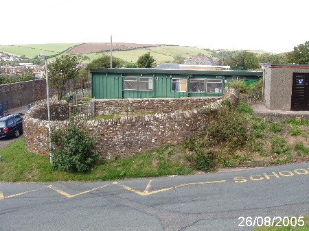
Ambleside. No trace. Grid ref: 337700,504600.
Possible site is where Pinfold Garage is now built. No trace found on OS maps
Anthorn Bridge Pinfold, Wigton. No trace. Grid ref: 319495,558237.
Shown as a Pinfold on the 1868 OS 1:10,560 map but site now occupied by a Community Hall
Appleby – Scattergate Pinfold. No trace. Grid ref: 368110,519840.
Shown as a Pinfold on the 1859 OS 1:2,500 map but site position not clear. Possible site now surrounded by modern housing
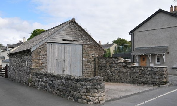
Appleby – Bondgate Pinfold. Grid ref: 369130,519980
This pinfold is named on the 1859 1:2,500 OS map on the edge of an area of strip fields. It is unusual to have the building as part of the pinfold and this may have been added as a practical facility when its original function was no longer required.
Armathwaite Pinfold, Penrith. No trace. Grid ref: 350641,546269.
Shown as a Pinfold on the 1868 OS 1:10,560 map but site is now clear. Existing field walls and fallen stones may be part of original Pinfold.
Aspatria Pinfold. No trace. Grid ref: 314280,541811.
Shown as a large square Pinfold on the 1883-87 OS 1:2,500 map on a site now occupied by Aspatria School.
Barbon Pinfold. No trace. Grid ref: 362500,482168.
The pinfold is shown on the County Series 1st Edition OS map of 1862 close to a small stream. The site is now part of a field. Landowner has no knowledge of a pinfold on the site.
Bassenthwaite. (Kilnhill) Grid ref: 321664,532556.
Shown on the 1895 1:2,500 OS map this pinfold is hidden away in a small thicket and in poor repair.
Beckside, Ireleth. No trace.
Archive reference to Pinfold Parrock sold. No trace on OS maps.
Bewaldeth Pinfold,
Bassenthwaite. Grid ref: 321012,534866
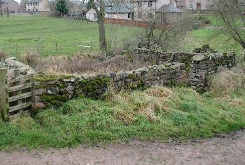
Located on private land belonging to Low Garth Farm, Bewaldeth and shown as a Pinfold on the 1867 & 1886 OS maps but as a Sheepfold on the 1900 OS 1:2,500 map.It is in a dilapidated condition and stands in what is now a wet marshy area. Unusually it has two gateways and may have been the Manorial Pound for the Manor House at Low Garth Farm. It is ideally located for this function as it is near the foot of a track heading towards open fell. Further along the fell track are the remains of an ancient Friends Meeting House and burial ground.
Blindbothel Pinfold, Lorton. (Whinfell). Grid ref: 314413,525795
Located beside the cross fell track over Whinfell to Mosser. This ancient way would have provided a direct route from the Lorton Vale to the fertile valley fields of Mosser and access to the high summer pastures on Whinfell.
This fold is shown as a Pinfold on the 1867 OS 1:10,560 map and is still in use today albeit with wooden rails to enlarge the capacity. It is close to a stream coming from the fell and the pinfold probably originally served the purpose of impounding sheep and cattle illegally grazing on the common following the driving of Whinfell. Whinfell Common was enclosed in 1828 and the map extract here shows the retention of the pinfold after enclosure.
Blindcrake Pound. Grid ref: 314700,534700
Located in the corner of the village green, much altered and now being used as a storage area containing a wooden shed. Structure is shown but not named on the 1900 1:2,500 OS map. The water source for the village and the impounded animals was a pond on the green, now drained, not the stone troughs placed alongside the nearby wall. Blindcrake village was designated a Conservation Area in 2001. Horace Winter in his “A History & Survey of Blindcrake”, printed in 1987, states that the village green “was part of the Isel Estate, and previously the site of the village pond, called the Mortar Dub, which was used for watering stock, and washing horses legs after ploughing. It was blamed for recurring fevers in the village, and after 1900, due mainly to the efforts of James Teasdale of Millstone Moor, it was drained by Cockermouth R.D.C, in spite of strong opposition by local farmers. After this was done the fevers subsided. The stone walled Pound in the corner of the Green was still used to impound stray stock. (Kirkgate Centre, Cockermouth). Recorded in the Manor Of Isel papers held at Carlisle Records Office (CRO D/LAW/1/229) are 2 undated notes giving the two decisions of the Manor Court which read: John Carter of Blindcrake & Henry Robert Brisco of Bothel for a pound breach of the pound at Blindcrake, according to pain 6s 8d. Wm Carter presents the Pinfold at Blindcrake to be out of repaire. No fine recorded.
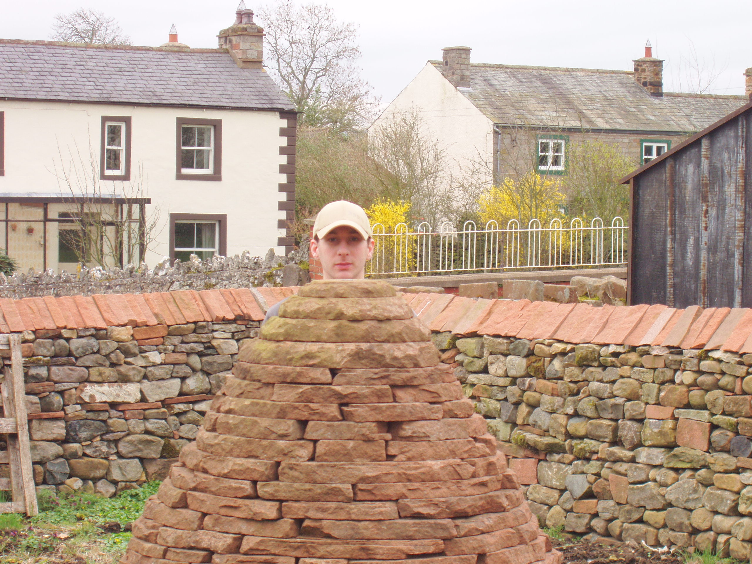
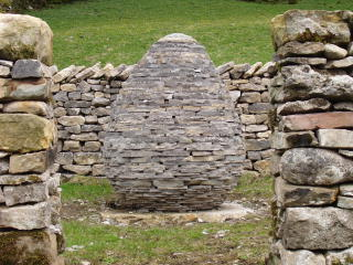
Bolton Pinfold. Grid ref: 363760,523170
This pinfold is not named on OS maps but the 1860
1:2500 and 1863 1:10,560 maps show a structure on
The site.This is a large almost square pinfold that was constructed by Andy Goldsworthy, on the site of the
original village pinfold, as part of the five year public art, landscape and environment commission, managed and developed by Cumbria County Council. (1996-2002) It is one of a series of 6 “Cone Pinfolds” where a stone cone has been constructed in the centre of the fold as a
public artwork.
Bothel Pinfold. No trace. Grid ref: 318085,538620.
This pinfold is shown on the 1867 OS 1:10,560 map but no trace now exits. Local information indicates that it was removed by Cumbria County Council in the 1950’s.
Bowness-on-Windermere Pinfold. No trace. Grid ref: 340540,497170.
The 1862 OS 1:10,560 map shows the pinfold on the northern edge of the town but no trace could be found. The town has expanded considerably and the pinfold was probably lost as the large villas were built on Lake Road in the mid 1900’s.
Braithwaite Pinfold. No trace. Grid ref: 323026,523500.
This pinfold is shown but not named on the 1864 1:2,500 OS map but was not recorded on the revised map of 1868. It was sited on the village common and in 1818 it is recorded in manor court records that: “We the six jurors, request that the said township of Braithwaite and Coledale and Rogerside to put the Lordship’s pinfould into good repair and every other thing that appertain to the said pinfould so that it may be reddy to put anything in that may encroach on the said Manners and Waste Ground”
Brampton Pinfold, Appleby. Site only. Grid Ref: 368233,523115
The site of the Brampton Pinfold is opposite to Brampton Hall and shown on the 1863 OS 1:10,560 map. It’s proximity to the “Manor House” and a marked well indicate that it is possibly the Manorial Pinfold for the area.
When excavating the site for the foundations of the Village Hall, now built on the spot, a large stone believed to be a tether stone used in the pinfold was found and is now at the roadside.
Brampton Pinfold, Carlisle. No trace. Grid ref: 353497,561193
The pinfold site on Fair Green is shown on the 1868 OS 1:10,560 map as a rectangular structure. According to CWAAS Vol LXXIII page 302 the Police Station now occupies the site of the old pinfold and tithe barn.
Brigham Pound. Grid reference 309133,530006
This pound is named on the 1864 OS 1:2,500 and the 1867 OS 1:10,560 map. It is shown in open countryside on the banks of Ellerbeck, a tributary to the River Derwent. Although well preserved it may have been altered from its original shape, due to housing development, as the shape is irregular with one straight wall. It is approximately 16mtrs by 11mtrs with a modern gate. It was shown, in 1867, on the edge of common land with several tracks across it and the original ford through the beck is still in place but usefully supplemented by a bridge.
Brisco Pinfold. Grid reference 342232,551786
The only reference found is in the Transactions of the CWAAS New Series Vol XVII page 53 where it is recorded in court rolls in May 1715 that Pinner William Coates was appointed. No trace of the site could be found on maps or in the village a lthough an area of common land on the south side of Brisco seems a likely site.
Brothybeck Pinfold, Sebergham. Partial. Grid ref: 334247,542723.
Shown and named on the 1868 OS 1:10,560 map as a pinfold this location is unusual. It is, when it was visited, overgrown and in disrepair but the original footprint of the structure is clearly discernible. The 1868 map shows it close to a stream on a secondary track over Sebergham Common, which appears to be enclosed at this time and although not near a settlement its isolated location the map shows it is near a crossroads with an Inn, nearby mill and a tile maker.
Brough Pinfold. (Church Brough) Grid ref: 79384,514214
This is a circular pinfold constructed by Andy Goldsworthy, on the site of the village pinfold, as part of the five year public art, landscape and environment commission, managed and developed by Cumbria County Council. (1996-2002) It is located in the grounds of Church Brough school.
The original pinfold is shown and named on the 1859 OS 1:250,000 map and is on the edge of Coltsford Common close to the beck. The Monuments record SMR 4227 notes that the surveyor could not locate it in 1996.
Burgh- by- Sands Pinfold. No trace.
A petition for the erection of a pinfold was signed by 36 inhabitants of the Barony of Brugh (Burgh) in 1819 but no evidence of it being built in the Barony, consisting of Burgh, Aikton, Drumburgh and Westlinton, has been traced. The petition reads:
Barony of Brugh. June 23rd 1819.
“We the undersigned being Inhabitants of the Barony of Burgh having taken into consideration the Damages done to Inhabitants within the said Barony by People who turn out their Cattle, Horses etc. Into the High Roads and lanes within the said Barony whereby several trespasses have been committed upon the fields of the Inhabitants adjoining the said Highways and lanes we therefore think it necessary to have a Pinfold erected within the said Barony to prevent such trespass in future”.
Burton in Kendal Pinfold. Site only. Grid ref: 352870,476530
The site is shown on the 1862 OS 1:10,560 map as a rectangular structure. It was demolished to make way for 10 council houses in 1948.
Buttermere Pound. No trace.
The only record found for Buttermere was in the record of the Court Leet when on 16th October 1719 it was reported that the Turnmen of Buttermire presents the pound fold gate lyeing down and Amercie the inhabitants of the township 6s 8d.
Caldbeck – Potts Gill Pinfold. Grid ref; 331845,537334.
This pinfold, not named on an OS map, nestles amongst farm buildings. It is a rectangular pinfold of random field stone with one wall built against a field bank. It is situated on the boundary between the fell land and cultivated fields and beside tracks that lead along the fell boundary joining the small communities. A stream runs nearby. This pinfold has been restored and stabilized as part of the Sheepfolds project by Andy Goldsworthy. Its strategic position next to the fell indicates that it may have been specifically used to impound animals found illegally grazing on the fell.
Caldbeck – Townhead Pound. Grid ref: 33195,539202.
This circular pinfold is shown on the 1863 1:2,500 OS map at the foot of Smithy Lane as it enters the hamlet of Townhead. Only part of the wall appears to be left and this forms part of a garden boundary.
Cark-in-Cartmel Pound. Site only. Grid ref: 336629,476677.
A circular pinfold stood next to the river at Rosthwaite bridge Cark. Shown on the 1890 1:2,500 ODS map and on the 1957 OS 6 inch map but now only an overgrown mound marks the site.
Carleton Pinfold. No trace.
Site could not be located on any OS map. The reference found was to a pinfold in Carleton in the Title Deeds of the Carlton Hall Estate held at Carlisle RO ref DCC2/23. The document refers to a piece of land bought by a John Birbeck in 1823 and “lying near the Place where the Pinfold at Carleton aforesaid stood”.
Carlisle – City Pound. No trace. Grid ref: 34016,556498. Shown on the 1746 map held at Carlisle RO. Site is now the Sands Centre.
Carlisle – Newtown Pinfold. No trace. Grid ref: 338920,556000. Described as Newtown Animal Pound on SMR 10552 and sourced from the OS First Edition 6”.
Carlisle Gate Pinfold, Wigton. Grid Ref: 323855,541703 approx.
In 1780 it cost George O’Brien 5s to repair this pinfold and in 1929 it was in disrepair again. An approach was made to Lord Leconfield asking him to sell it to the landowner of an adjacent property. This sparked legal arguments around ownership and rights to keep stock in the pinfold. Cumbria Archive ref. SL/34. There is no trace of the pinfold on OS maps, local enquiries were negative and the site could not be traced.
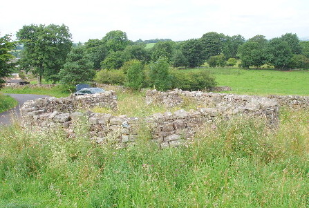
Cartmel Pound. Grid ref: 338033,478671.
This site is shown on the 1851 OS 1:2,500 map as a pound. Some parts of the original walls can be discerned but it now serves the purpose of a storage barn or garage. The water source is now culverted to allow for the modern driveway to an adjacent house. The site is recorded on the Cumbria Sites and Monuments Record as SMR 16120. Locally the building is referred to as the roller house as it used to house a road roller.
Casterton Pinfold. No trace. Grid ref: 362461,479720.
A small steep piece of river bank is known locally as the Pinfold but not found named on any OS map. The 1898 and 1914 1:2,500 OS maps show outlines of a plot next to the river but it is not named so no site can be confirmed.
Cliburn Pinfold, Penrith No Trace.
The 1863 OS map shows a pinfold just outside the graveyard of St Cuthberts Church, Cliburn. It appears as a semicircular structure on the map. Nothing remains of this pinfolds. Contributed by James Underwood February 2016.
Clifton Pinfold, Penrith. No trace.
Although mentioned in the Westmorland Quarter Sessions papers ref. KRO/WQ/SR/273 the site could not be traced. The record reads “Presentment, Joseph Milner of Barton gent. And Dorothy Bowness of Clifton spinster, on 21 August 1757 broke into and entered the pinfold at Clifton and rescued one filly and one colt impounded by Margaret Robinson widow for doing damage to her ground. No bill”.
Cockermouth Pinfold. Grid ref: 312866,530807.
The site is marked by a small copse of trees but there are no signs of the original rectangular pinfold shown on the 1866 OS Maps and Town Plan. The pinfold was at the south end of a large field named the Deer Orchard which may account for its location.
Colby Pinfold, Appleby. No trace. Grid ref: 366730,52070.
The site of this rectangular pinfold is shown on the 1861 1:2,500 OS map and has now been replaced by a house named “Pinfold House”.
Coldbeck Pinfold, Ravenstonedale. Site not confirmed. Grid ref: 372240,504350.
The pinfold is marked on the 1859 1:2,500 OS map but road improvements and landscaping since then make it difficult to confirm the exact site. This may have been a paddock used as a pinfold. A small stone building may mark the site.
Crackenthorpe Pinfold, Appleby. Grid ref: 66200,522200.
Shown on the 1861 1:2,500 OS map as a pinfold with two small pools known as Gaylock Pools nearby. Cumbria SMR Number 16749 updated 1994.
This pinfold is approx.11mtrs by 10mtrs and in poor condition with one wall reduced to foundation stones only. There is evidence of several repair attempts over the years it has stood here on the edge of an access way to an old roman road.
Croasdale Pinfold (also known as Crossdale).
The reference found is in Carlisle RO ref D/DI 1 and 9 where there are references to reduction in the width of road from “pinfold to the stone quarry” and a “Croasdale Pinfold payment”. No trace of a pinfold or quarry could found. Field patterns on the 1876 OS map indicate that this area was subject to the Enclosure Act and the pinfold may well have been removed as a result.
Crook Pinfold, Kendal. Grid ref: 346428,495109.
This is a restored pinfold, although the walls are much reduced in height, beside the road at Crook. It measures 20mtrs by 5mtrs and is close to the parish boundary. A spring in the far corner would have provided drinking water for the stock. The 1860 1:2,500 OS map shows the pinfold placed on the roadway.
Crook Pound, Kendal (Pound Farm). Grid ref: 347065,495304
Shown and named on the 1860 1:2,500 OS map as an area of land with a large rectangular structure. In its isolated position it was probably used originally by drovers. It has several structures or buildings shown on this site but they appear to have been demolished when the farm developed as Pound Farm. Now a holiday lodge complex.
Crosby Garrett
Pinfold. Grid ref: 372700,509243.
It is referred to locally as a pinfold and if it was then it must have been the country’s smallest. This very small circular structure is unlikely to have been a pinfold because of its small size, about 4 metres diameter. It also has a small outlet at ground level on its north side indicating that it may have been the site of a well. A local feature is the marking of well sites with elaborate stone structures as in the nearby village of Soulby. It is not shown or named on early OS maps.
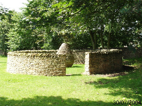
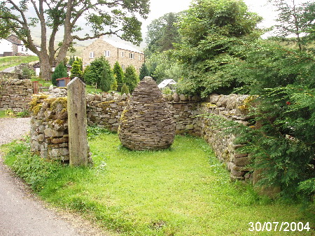
Crosby Ravensworth Pinfold. Grid ref: 362102,514266.
This pinfold site is shown on the1859 1:2,500 OS map and was re-constructed by Andy Goldsworthy, on the site, as part of the five year public art, landscape and environment commission, managed and developed by Cumbria County Council (1996-2002). It is one of a series of 6 “Cone Pinfolds” where a stone cone has been constructed in the centre of the fold as a public artwork.
Crosby Pinfold, Maryport. Site not identified.
Information received indicated a pinfold in the grounds of Westlands Farm but no trace found. Not found on any OS maps.
Crosthwaite Pinfold Hill, Lyth. Grid ref: 346230,488319.
This is a large roughly circular hedge pinfold shown on the 1896 1:2,500 OS map as Pinfold Hill. It is in poor condition with very little of the stone walling, possibly an original feature, left. The walling would have supported the hawthorn hedge that surrounds the site. The interior is as its name suggests higher than the surrounding land. This pinfold would have been built specifically at this spot because of the rocky outcrop at its centre. Around this large outcrop the land is higher, as a result of the deposits caused by receding ice when the valley was formed Before the valley was drained the pinfold would have been the only dry spot in this part of the valley and a refuge for grazing cows and sheep. It is said that “pinnell” was quarried from within the pinfold. Pinnell is a mixture of small rock and sand deposited naturally as the valley formed and was ideal hardcore for surfacing the local roads and tracks. The Parish Records show that as a result of the Enclosure Award of 1815, the pinfold, known as Low Gate Quarry after the nearby Low Gate Farm, was transferred to the care of the Parish Council. It is currently let at a minimal rent.
Culgaith Pinfold, Penrith. Grid ref: 361062,529706.
This is another pinfold partly demolished since 1900 for road widening, however what is left is kept in good order. It is shown but not named on OS maps including the 1900 1:2,500 OS map. Interestingly its location at a crossroads in the village is significant in that old paths from enclosed land converge to the pinfold and nearby were the smithy, institute, church and more recently the war memorial. Another indication of the pinfold’s status in this village is that it is registered on the Common Land Register as CL439.
Dalston Pound, Carlisle. Grid ref; 337147,549042.
A small triangular pinfold at the south end of the village of Dalston. In good condition with one side bordering the River Caldrew. Approx. 7m by 20 m. It is registered by Dalston Parish Council as Common Land CL 332.
Dalton-in-Furness Pound. Grid ref: 322645,473812.
An ancient pound at Goose Green which is approx. 11mtrs in diameter with a modern metal gate. It is shown on numerous maps the clearest of which is the Merryweather town plan of Dalton surveyed in 1825.It is Grade II listed and even mentioned in an account of the Civil War when in 1643 the crews from a small fleet of Parliamentary ships anchored at Piel Harbour joined locals and advanced on Dalton the men occupying the Pinfold in their attack.
Dalton-in-Kendal Pound. Grid ref: 354227,476812
This site is possibly a pre-medieval village pound according to Tom Clare in his book Archaeological Sites of The Lake District. It consists of a broken circle of oval limestone boulders. It is a registered archaeological site and mentioned here for reference only.
Dean. Site not found. Grid ref: 307500,525247
Information received that there was a pound in Dean but no evidence found.
Deanscales Pinfold. Partial. Grid ref: 309438,526326.
This site, with possibly two original walls now the field boundary, is in the corner of a piece of common land on the far side of a beck. It is shown on the 1867 1:10,560 OS map.
Dearham Pinfold, Maryport. Grid REF: 307126,536294.
This corner pinfold is now much encroached upon by modern housing even since it was recorded on the 1889 1:2,550 OS map. Later maps show the progress of this encroachment up until the house, named Pinfold, was built around 1960. The lane beside the pinfold leads to Dearham Park which is now enclosed fields and around the village boundaries are signs of strip field farming and enclosed fields indicating the importance of a pinfold in this ancient village.
Dent Pinfold. Grid ref: 371590,483280.
The 1853 OS 1:10,560 shows and names a Pinfold at this reference but 40 years later the 1893 OS 1:2,500 map names it as a sheepfold. As the site is on the fell side far from a settlement it is unlikely to be a pinfold in terms of the definition used in this study. Noted here for reference purposes.
Eaglesfield Pound, Cockermouth. Grid ref: 309510,528217.
This is a small pound built between a steep bank and a stream on the edge of the village. It is not named but the structure is outlined on the 1881 1:2,500 OS map. The Parish Council repaired the walls and planted an oak tree to mark the 2000 millennium.
Edenhall Pinfold, Penrith.Grid ref: 356567,532622.
Although marked and named on all early OS maps as a sheepfold it has the hallmarks of a being a pinfold. It is at the edge of a strip of “common land”, it has high walls and is beside a track leading to Langwathby Moor. There is however no obvious water source. The parish council have ownership and they rent it out, at a nominal amount, to a villager for use as a garden.
Egremont Pinfold. Grid ref: 301202,510700
The pinfold is marked on the 1872 1:2,500 OS map as in Lamb Lane but site today has modern housing built on it. No trace remains.
A pinfold was in existence in 1677* as the Borough Court of Egremont records that John Skaif was presented for rescuing several sheep from the Borough Pinfold as they were being driven to it and notes that he was fined 8s 4d. Another entry for October 17th 1681 records that the pinfold “was broken down and cast downe every yeare by evil persons who kept unlawful goods to the great loss and damage of the town and burrough. We therefore , the said jurie for the public good of our town and burrough doe give and grant on behalf of the old town and burrow aforesaid to our well beloved friend and Burrowman, John Williamson of Egremont, Batchelor, two pieces of Burrow common wastes or mesne ground called Low Ridding Nooke, and Greenthwaite Nooke, which adjoin the said John Williamsons ground, containing one acre, or thereabouts, to him, for ever, for and in consideration of building a common pinfold two yards high in wall, and as large in compass as the said now hedged pinfold doth contain, within one year, more or less, he the said John Williamson assigns paying unto the Lord the fee thereof the annual quit rent of one penny”.
Embleton Pinfold. Grid ref: 316264,529406.
I was informed about this unusual pinfold by a local parish councillor who has known this building to be called the pinfold for over 50 years. The open structure attached to the lean-to is the pinfold. It was roofed up to about 20 years ago and belongs to St Cuthbert’s Church in whose grounds it stands. The adjoining building is the meeting room and storage room for the church.
It is not named on the OS maps but is shown on the 1864 1:2,500OS map as an open structure.
Field Broughton Pound. Grid ref: 338531,481606.
A well maintained pound on White Moss Common, listed as “Oval plan enclosure approx. 8mtrs by 11 mtrs with wall approx 2 mtrs high”. Parish Council records show that the pound was used for storage and also had to be cleared of rubbish on several occasions. It has been regularly repaired, most recently in 2004 when with the aid of Lottery funding it was restored to its current condition.
Gaitsgill Pinfold, (Gatesgill) Carlisle. Site only. Grid ref: 338796,546759
The site of this pinfold is subsumed into the private garden of Bridge House formerly Pinfold House and is not accessible. Shown but not named on OS maps it is also registered on the Common Land Register, CL 331.
Garsdale Pinfold, Sedburgh. Grid ref: 374912,489648.
Situated at Pinfold Farm in Garsdale is a fold recorded on the 1852 1:2,500 OS map and which gives its name to the area and to the roadside cottages of Pinfold House, Pinfold Farm and West Pinfold (now Rose Cottage). It is a small fold that was until recently used to rear geese and now contains a garden shed.
Gleaston, Ulverston. Grid ref: 325832,470750.
Although included here this fold is probably a sheepfold or washfold. It is on the bank of a stream with two entrances. OS maps which show the area of common in Gleaston to have had several sheepwashes and shows this one as a sheepfold on the 1889 1:2,500 OS map although locally it has been called a pinfold.
Grange-over-Sands Pound. Grid
ref: 340413,478119.
Shown as a pound on the 1860 OS 1:10,560 map. The site now has a preserved well known as Charney Well but no trace of the pound. Housing development around the site prevents its accurate location being identified.
Grasmere. No
trace.
The early OS maps show only sheepfolds. However in the sixteenth century Grasmere boasted 3 folds used as pinfolds. Two were for stock straying from manors of Wythburn, (to the north) and Rydal (to the south), and one for strays belonging to the tenants of Grasmere . In the 1847 Rate Book for Grasmere it is recorded that the Pinfold belonging to the Parish was falling into disrepair.**
*The Harvest of the Hills by Angus Winchester p 117.** CWAAS Transactions Vol XXVIII page 288
Great Asby Pound , Appleby.
Site only. Grid ref: 368306,513340.
Outline only shown on OS maps. A local source confirms that this pound was demolished circa 2000 and the stone used for a boundary wall next to Asby Hall. This was a registered monument SMR 15268 and was visited in 1996 by the surveyor who described it as “a small rectangular enclosure of stone with no entrance other than a small narrow gap, located on the north east edge of Gt Asby village”.
Great Broughton Pinfold, Cockermouth. Grid ref: 307432,531634.
The Great Broughton Parish records for 12th October 1793 state that there was a need for the “maintenance of pinfold door and cheeks” of this pinfold. On 23rd March 1886 a Mr Paisley the owner of an adjacent property was offered purchase of this pinfold by the overseer. As a result he contacted Mr S.G.Saul in Lord Leconfield’s office at Cockermouth Castle who questioned whether it could be sold as it was now the responsibility of the Highways Board of Cockermouth. The outcome is not recorded but today it is rented from the council, is complete and well used as a private domestic garden. It is shown on the 1895 1:2,500 OS map.
Great Musgrave Pound. Grid ref: 376800,513500
The Cumbria Sites and Monuments record, entry SMR 4119 describes this site “at west end of village is a sub-rectangular enclosure, later used as a pound, but probably of earlier origin. The bank survives on SW side up to 2.5m high”. It is believed to be a medieval earthwork and as in the case of Dalton-in-Kendal is note here for reference only.
Great Strickland Pinfold, Penrith. Grid ref: 356150,522999.
This low walled pinfold is complete and maintained well. It is approximately 5mtrs by 6mtrs and is named on the 1898 1:2,500 OS map. The entrance is too narrow and the walls too low for effective animal use and may be the result of consolidation work after it fell into disuse.
Although maintained by the parish council they do not own it. A modern house has built immediately behind the pinfold named Sycamore House, presumably after the 50 year old tree in the pinfold rather than the over 200 year old pinfold!
Grayson Green Pinfold. Site
only. Grid ref: 299787,524822
Shown on the 1900 1:2,500 OS map as “Old Pinfold” it has now disappeared. The corner of the field where the pinfold was located also had a well which has likely been neglected and the site is now very swampy. A modern housing development makes close access to the site impossible.
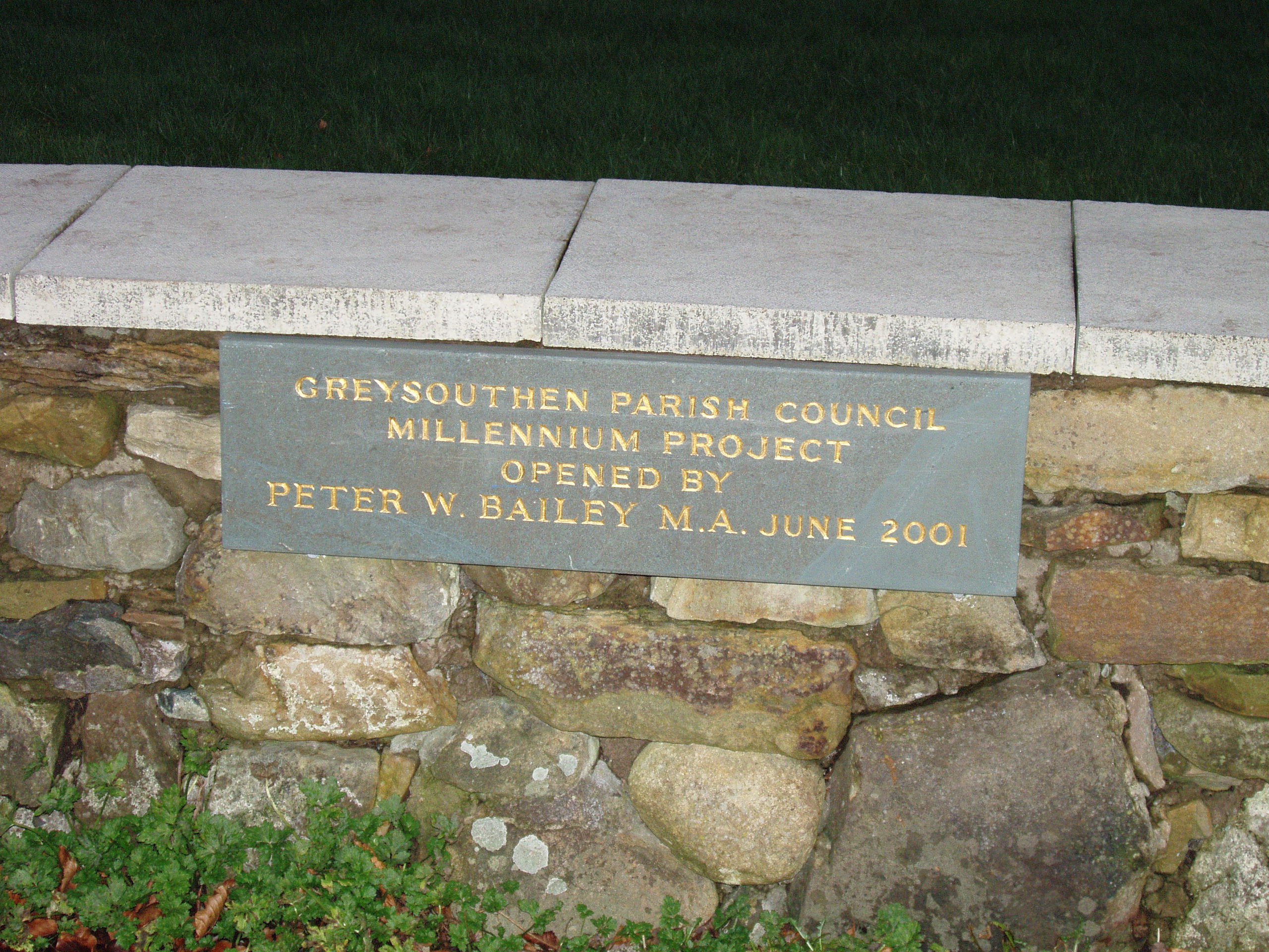
Greysouthern Pinfold. Grid ref: 307194,529342.
This large oval pinfold has been much modified over the years and is now a village amenity. The latest alterations happened at the millennium when it was made into a play and seating area for the community. A plaque commemorates the opening in June 2001.
The 1866 1:2,500 OS map shows this pinfold in a typical location for an early pinfold, near a well and just off the central open area in the village on the edge of open farmland.
Hardbank Pinfold, Warwick Bridge. Grid ref: 35200,556780.
Shown on the 1863 1:2,500 OS map this pinfold is complete but shows the signs of changes over the years to allow access to neighbouring properties.
Hartley Pinfold, Kirkby Stephen. Grid ref: 378280,508895.
An irregular shaped, allegedly heart shaped to reflect the name of the village (sic) pinfold.
It is shown on the 1859 1:2,500 OS map and stands on a piece of common land beside the stream. It is of mainly dry stone wall construction with a modern wooden gate. In 1957 it became Grade II listed and is described as
“on the village green, possibly late C18 with rough dressed gate posts, trapezoid in plan with C20 wooden gate to the centre of the side facing street”
Hawcoat Pound, Barrow-in-Furness. Grid ref: 320300,471920
The site of a pound is recorded on the Cumbria Sites and Monuments Record SMR 2291 where it is noted that in Richardson’s Furness Past & Present “an ancient pinfold, now a garden in the centre of the village of Hawcoat, was the scene of a smart skirmish between Royalists and Parliamentarians in 1643”. This site could not be found.
High Hesket Pinfold. Grid ref: 347990,543630.
Site shown on the OS 1863 1:2,500 map but site is now a bungalow.
High Ireby Pinfold. Grid re: 323038,537067.
Site shown on 1867 1:10,560 OS map but no trace left.
High Newton, Grange-over-Sands
Site only. This was a circular pound next to a steeping dub in the north weast end of the village. There is no trace left with the site now a well tended community area.
Hilton Pinfold, Appleby. Grid ref: 373240,520630.
This pinfold is close to Hilton Hall bordering the village green with a water trough nearby. It is shown but not named on the 1861 1:2,500OS maps and later ones.
Hunsonby Pinfold, Penrith. Grid ref: 358026,535500
This Pinfold is shown on the 1867 OS 1:10,560 maps. Only a part of the wall is still in existence but the circular outline can be traced. It is in a picturesque setting next to a stream on the edge of the village.
Hutton Roof Pinfold, Kirkby Lonsdale. Grid ref: 356960, 477820.
This site is shown on the 1862 1:10,560 OS map. Just the outline of this pinfold remains which shows it be about 10mtrs by 12mtrs with a stream alongside.
Ireleth. No trace. Grid ref: 321983,477592.
In main street is Pinfold House but no trace of a pinfold. The area is built up and the 1890 1:2,500 OS map does not show a pinfold.
Isel Old Park Pinfold. No trace.
There is a reference to Isel Old Park Pinfold in the Manorial Records Court Roll for the Manor of Isel 1660-1712 at Cumbria RO ref D LAW /2/6 but location could not be found.
Kendal – Ferney Green Pinfold. Grid ref: 351113,493353.
This pinfold is shown on the 1860 OS Town Plan of Kendal but by the 1898 1:2,500 OS map Kendal Green had been developed and it was not shown. Site is now an open space.
Kentmere. Grid ref: 345790,504092.
An irregularly shaped pinfold is shown on the 1860 1:2,500 OS map but it has since been altered to allow access to a nearby property. It is referred to in a book by Len Hayton “The collected tales of a Lakeland Lad” where he writes “my grandfather always referred to the stretch of road from Low Bridge House to the bottom of Church Hill as the Pumple Syke, his pronunciation of Pinfald Syke. The Kentmere village pound was situated just outside the gate to Pumple Syke. It was a boggy place with a stream flowing through it which never seemed to dry up in a drought”. Restored in 2000.
Kirkandrews-upon-Eden Pinfold, Carlisle. Grid ref: 335374,558394.
This is a triangular site shown on the 1867 1:2,500 OS map as “Green” and later on the 1971 1:2,500 OS map as “The Common” but never as the pinfold. The parish council maintain the area and refer to it as the Pinfold. It is not possible to see how this was a pinfold as the area’s use has obviously changed its appearance over the years.
Kirkby Lonsdale Fellside. Grid ref: 359285,479419.
This fold is a bit ambiguous as it is shown but not named on the 1859 OS map and from 1898 is named as a sheepfold. Close examination shows the building has been much amended and appears to have two entrances. It is next to a stream and on the 1914 OS map there are two structures named as a sheepwash and sheepfold. It is unlikely to have been a pinfold and is recorded here for interest.
Kirkby Stephen Pound. Grid ref: 376750,509350.
The Cumbria Sites and Monuments Record 16914 suggests this may have been an animal pound but it is not named as such on OS maps although later OS maps show a building near the actual site. The location is now a pile of rubble not discernible as a pinfold.
Kirkby Thore Pinfold, Appleby-in-Westmorland. Grid ref: 363840,525753.
This pinfold is Grade II listed. Described as “Village pound, probably late C18. Rectangular enclosure has 5ft high coursed, squared, rubble walls with triangular coping stones; C20 gate in east wall. Late 19c building to rear originally served as school lavatory before becoming the fire-engine house; now disused. Squared snecked rubble with quoins. Welsh slate roof. Single storey, built at right angles to road with door in end wall.”
This is a rectangular structure that appears to have been extended since its original construction probably at the time the small roofed building was added. At the time of the first visit in April 2004 it was in good condition and used for storage. In July 2004 the wall to the right of the gated entrance had been demolished and a tractor was parked within the pinfold. The pinfold is shown on the First Edition County Series of the Ordnance Survey map for 1863.
Kirkoswald Pinfold, Penrith. Grid ref: 355601,541129
Clearly shown on the 1888 1:2,500 OS map but it had disappeared from the map and replaced by a Smithy on the 1900 1,2500 OS map. Since then garage buildings have been built on the site. It cannot be confirmed but some stonework at the end of the buildings still remains which may be part of the pinfold.
Lamplugh – Bird Dyke Pinfold. Grid ref: 309078,521358
Shown as a pinfold on the 1895 1:2,500 OS map at the foot of a track to the open fell. Later maps show the house built next to it and a diversion in this track. Pinfold is now overgrown and in derelict condition.
Lazonby Pinfold. Grid ref: 354710,539590.
Shown on the 1863 1:2,500 OS map as next to a smithy but not shown on the 1900 OS map. Location is now an industrial site with housing and although access could not be gained it seems unlikely that it still exists.
Levens Pinfold. Grid ref: 348603,486764.
The site has been identified but no trace of the pinfold now exists. It is believed that the pinfold was lost when after the Heversham Enclosure Act of 1805 the allotment of the commons, including the area of the pinfold, was made to a William Addison. Indentures in 1817 and 1837 refer to the sale of Pinfold Lot and Pinfield Lot respectively. On 13th February 1876 a codicil to the will of John Pennie was proven and a freehold close of land called Pinfold Parrock in the occupation of Edward Dodd Kemp as tenant was sold.
Little Broughton Pinfold. Grid ref: 307851,531858.
This is a well preserved pinfold situated beside the old village green in Little Broughton and shown clearly on the 1886 1:2,500 OS map. It is owned by the parish council and leased to the owners of Birchless House who use it as a garden. In the Manorial Records held at Carlisle RO there is reference to the repair to the “pinfold door and cheeks” dated 12th October 1793.
Little Langdale, Pinfold How Bridge.
An indication that a pinfold may have existed, is in the name of this bridge in Little Langdale. Reference to this bridge being in decay is held in KRO WQ/SR/509. However it could not be found. It is included here for reference only.
Little Musgrave Pinfold. Grid ref: 376040,513130
The 1898 OS 1:2,500 map shows the Pinfold but local information is that about 10 years ago the site was cleared and a new cottage, Pinfold Cottage, was built in its place.
Longtown Pinfold, Carlisle. (C) Grid ref: 337686,568934.
Clearly shown as a two celled pinfold on the 1895 1:2,500 and the 1868 1:10,560 OS maps as a standing beside the road north of the bridge in Longtown. However the 1901 OS map indicates changes to the road to the north of the bridge and the bridge itself but the pinfold is not shown. I suspect therefore that the pinfold is a modern build near the original site. It is well kept and approximately 2.5 mtrs square.
Lorton Pound, Cockermouth. Grid ref: 316133,525481.
Traditionally the area of common land at the rear of the old brewery building in High Lorton is known as the poundfold. A circular structure is shown on the survey map for the enclosures made in 1827 but was not on later OS maps.
An early reference to the function of the pound as it related to grazing rights in the Lorton fells comes as early as 1474 when the Brackenthwaite Court deemed that “ Lorton Heders to be inclosed and kept inclosed during the open season and there the neighbours stray cattle may be driven”.
The Parliamentary Survey of 1649 uses the Poundfold as a boundary reference “and soe along Peals of the Tenters westwards to the Poundfold and so over white Beck to John Wilkinsons”.
Loweswater Pinfold. Grid ref:
312912,521765.
This isolated Pinfold on the banks of Loweswater
served a very rural community. It is built near the head of the
valley at a point between the open fell and improved grazing at the
valley head. It is shown on the 1863 1:2,500 OS map and is
maintained by LDNP.
In the Manorial Records of Sir Wilfred Lawson,
Baron, there is recorded in 1749 “We find stocks and pounfold in
good repair” and even earlier in 1674 it is recorded “By
examination of the constables find ye stock and poundfold to be in
sufficient repair”. This is an unusual entry and in contrast to
most Manor Court records that only record the condition of the
pinfold if it is need of repair.
Melmerby Pound. No trace. Grid ref: 361440,537300
Cumbria Sites and Monuments Record number 5860 records a circular earthwork as a cockpit or the remains of the village pound. The village also has a sheep washfold restored in 2001. There was an d poundbreak in 1863 but this is not confirmed.
Middleton Pinfold. Grid ref: 362536,487332.
Shown on 1859 1:2,500 map and later maps but farm development appears to have seen the end of this pinfold.
Millbeck Pinfold, Keswick.
On 1864 OS map but exact location could not be found on visit 17/09/2016
Milnthorpe Pinfold. Grid ref: 349630,461810.
Shown on the 1858 1:2,500 OS map but no trace now left due to development of the land. It is mentioned in the plaque at the entrance to Grisleymire Lane.
Mungrisdale Pound. Grid ref: 336446,530014.
Shown on the 1899 1:2,500 OS map and now used as a wild flower garden. One wall has been replaced with a hedge due to road widening.
Nateby Pinfold, Kirkby
Stephen. Grid ref: 377480,506840.
Shown on the 1859 1:2500 OS map but now no trace could be found. New houses and road widening probably caused its demise.o drag me around or click a corner handle to resize me.
Newbiggin Pinfold, Appleby. Grid ref: 363050,528640.
Site found but no trace of pinfold left. Roadside improvements with new walling probably caused its demise.
Newbiggin Pinfold, Penrith. Grid ref: 347090,529120.
Shown as a sheepfold on the 1864 1:2,500 OSmap however the conveyance dated 1910 refers to the site as a pinfold and confirms that the Jury agrees that Mr Hodgson takes the pinfold agreeing to do the walling himself.
Newton Reigny, Penrith. Grid ref: 348114,531484.
This pinfold is on the edge of the village of Newton Reigny and has been adapted to use as a garden and storage area. A field gate has breached the walls but it is otherwise complete. Shown on various OS over the years as a pinfold and sheepfold.
Orton Pinfold. Grid ref: 362400,508300.
Cumbria Sites and Monuments Record number 15196 refers to the site of this pinfold. In April 1986 it is recorded in the SMR that the minutes of the Court Baron of the Manor of Orton of 17 May 1843 refer to an application by John Simpson to build a house and smithy on the south side of Orton Pinfold. The application was granted. Around the turn of the century the smithy and house were known as Derby House. Sometime later it was modernised and is now known as Shallowford. A few yards north of Shallowford is the Methodist Chapel, built in 1833. The pinfold would therefore appear to have been situated between the old house and smithy, and the Chapel. No traces remain today.
Oulton Pinfold, Wigton Grid ref: 324440,551610.
A house used as a Poor House was built on the site in 1825 and only the wall of the original large pinfold is left.
Outgate Pound, Hawkshead. Grid ref: 335520,499872.
A banked pinfold which has suffered changes due to road improvements and is recorded as a Pound on the 1890 1:2,500 OS map. It is Grade II listed recorded on 15.3.1970 as
“Pound. Possibly C18 or earlier in origin. Stone rubble. Roughly rectangular enclosure, wall to street is approx. 13.5m long, low, with concrete coping and iron rails: post box in pier next to small gate. South wall is similar, north and west walls higher”.
The Parish Council suggest that Lord Buccleuch owns the pinfold and that local landowners are responsible for its upkeep.
Outhgill Pinfold, Kirkby Stephen. Grid ref: 378386,501566.
The 1859 and 1915 1:2,500OS maps both show this pinfold as originally circular but since then it has been partly reclaimed to allow a building and garden to develop.
The cone inside is by Andy Goldsworthy, as part of the five year public art, landscape and environment commission, managed and developed by Cumbria County Council (1996-2002). It is one of a series of 6 “Cone Pinfolds” where a stone cone has been constructed in the centre of the fold as a public artwork.
Papcastle Pinfold. Grid ref: 311089,531536.
This is shown as a square pinfold in a small copse on the 1900 1:2,500 OS map but now the site has various houses built on it. A reference found in Whitehaven RO ref D/LEC 299 roll 19/20 refers to the Papcastle Court held on 10th October in the 23rd year of the reign of Henry VIII ( 1533) reads: “ they present Thomas Lamplughtt of Doven (a village just north of Papcastle) by his servant for 1 foldbreach (fined 40d) and for 12 pigs (2s) 16 sheep and 30 geese on the cow pasture of the neighbourhood at the several season”.
Penruddock Pinfold. Grid ref: 342798,527723.
This pinfold is combined with a well has a nearby stream which makes the area boggy. Access is via a short wide track. It is in an open field area between the two settlements that make up the township. It is now owned by the Parish Council who maintain it.
Plantation Bridge Pinfold, Kendal. Grid ref; 348480,496600.
Shown as triangular and utilising the dry stone walls in the corner of a field. This site of this pinfold is on the 1860 1:2,500 OS map and close to Burrow Hall.
Pooley Bridge Pinfold. Grid ref: 347556,524486.
A pinfold that is maintained by the Lake District National Park with a seat to encourage its use! Although the dry stone walls are diminished in height and prone to disrepair this pinfold has stood on this site close to Mainshouse, now Manor Farm, since before 1861. It is next to a stream and on the edge of open moorland.
Quality Corner Pinfold, Whitehaven. Grid ref: 299176,519709.
Named on the 1867 1:10,560 OS map and shown as an irregular square shape in a field corner. Only a pile of stones now remain at the site.
Raisbeck Pinfold, Orton. Grid ref: 364740,507120.
The OS 1:2,500 maps name this structure as a sheepfold in 1857 and from 1914 a pinfold. The change in name seems to have occurred at the same time as the Raise Beck ceased to become a ford and was bridged by the appropriately named Pinfold Bridge. The cone inside is by Andy Goldsworthy, as part of the five year public art, landscape and environment commission, managed and developed by Cumbria County Council (1996-2002). It is one of a series of 6 “Cone Pinfolds” where a stone cone has been constructed in the centre of the fold as a public artwork.
Red Dial Pinfold, Wigton. Grid ref: 325824,546094.
This pinfold, of which there is now no sign, stood on a patch of waste or common land and was shown on the OS maps dated 1867 and 1900 but had disappeared by the 1925 version.
Redmain Pinfold, Blindcrake. Grid ref: 313660,533800.
No trace found of this pinfold which is shown on the 1865 1:2,500 OS map.
Renwick Pound, Penrith. Grid ref: 359500,543500.
This is a small area of` ground that is locally called the pound and believed to have been the place used to corral animals when there was a threat to the village from wild animals or raiding reivers. It is an irregular shaped piece of ground at the rear of several houses and has only narrow entrances and exits making it easy to block or defend. Listed here for reference purposes.
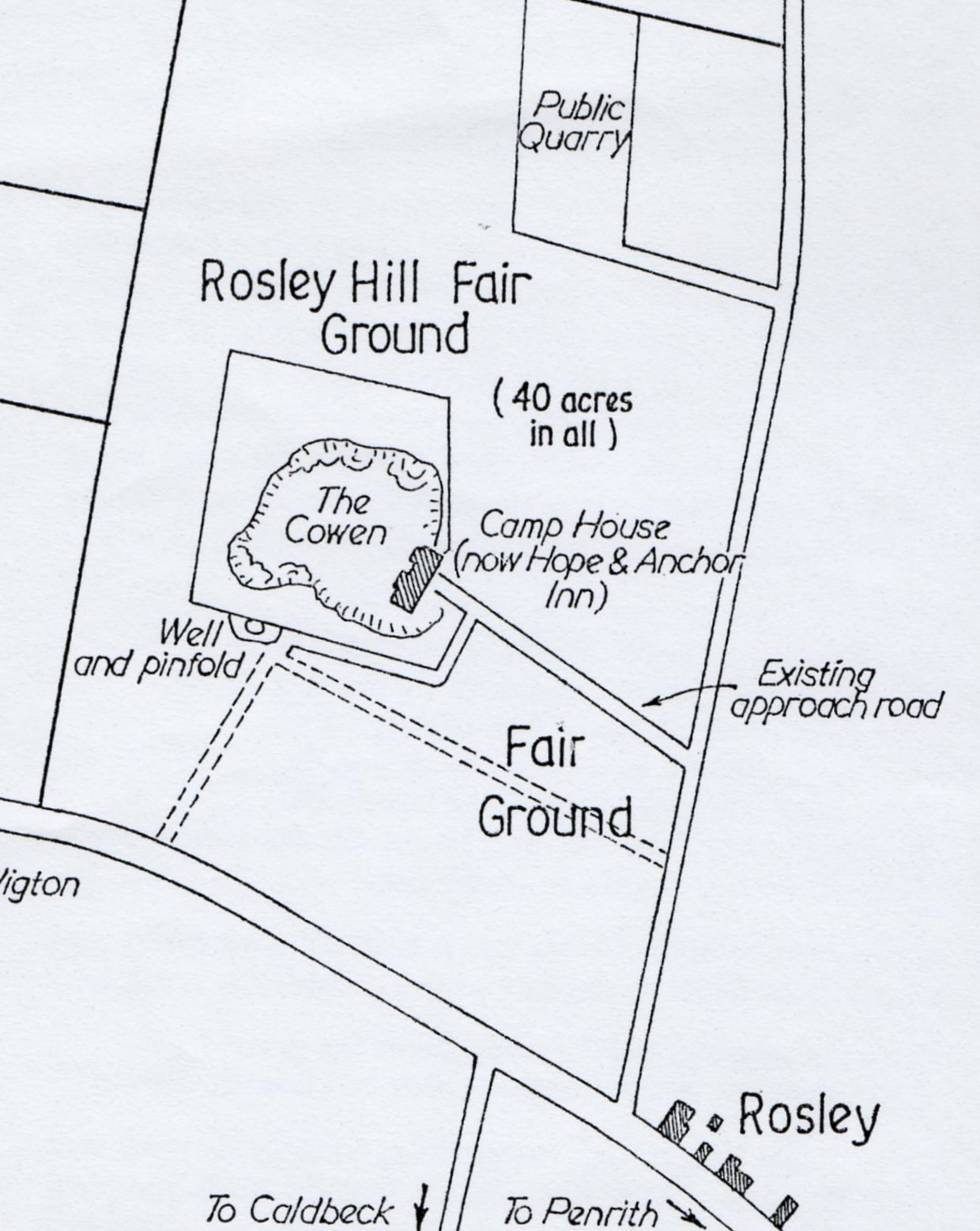
Rosley Pinfold, Penrith. Grid ref: 331814,545617.
The fairground at Rosley became a natural meeting point for travellers and drovers from the Solway plain in the north and the Scottish borders beyond. It was an open space of some 40 acres and is shown on the 1824 Enclosure Plan for Westward Parish. The pinfold is shown on the plan and would have served to impound stray cattle and horses during the fair. A well was in the centre of the pinfold and probably this accounts for its location.
The pinfold is shown but not named on the 1893 OS map but is named on the 1900 1:2,500 OS map. There is now no trace of the pinfold.
Roundthwaite Pinfold, Tebay. Grid ref: 360920,503300.
No trace is now left of this pinfold is shown on the 1881 1:2,500 OS map on the edge of the village at the conversion of several ancient tracks coming in from Roundthwaite Common. It had disappeared by the time the OS surveyor for the area made his 1898 version.
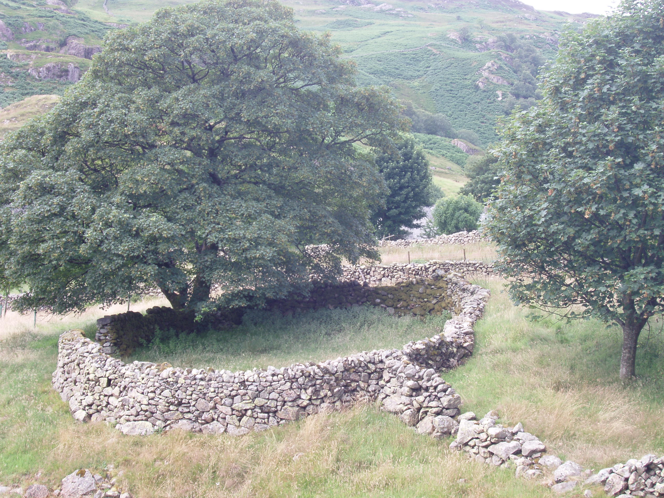
Sadgill, Longsleddale.
There are several large folds named as sheepfolds near the small settlement of Sadgill at the head of Longsleddale on the early 1:2,500 scale OS maps. Angus Winchester in his book “The Harvest of the Hills” refers to two pinfolds at Sadgill in the sixteenth century built by two owners of the dalehead, so that each could impound the other’s stock. These may be the folds marked as they appear to be on private land away from the public road.
Scales Pinfold, Ulverston. Grid ref: 327490,472270.
An area at Scales Green is known as the Pinfold and the 1891 1:2,500 OS map shows a circular structure in this area. It was not shown on the 1968 map. The area is still known locally as the Pinfold and is used as a childrens playground and private garden from which the Parish Council receives an income.
Seaton Pinfold, Workington. Grid ref: 301990,530350.
Pinfold and trough shown on the 1866 OS 1:2,500 map but this site is now built upon and no trace of pinfold was found.
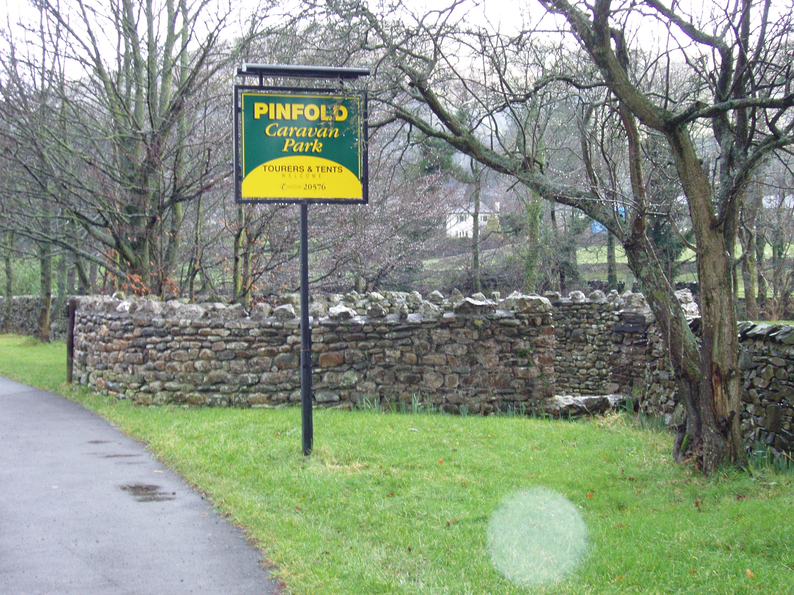
Sedburgh Pinfold. Grid ref: 366672,491951.
This is well preserved example of a pinfold shown on the 1894 1:2,500 OS map as a Pound. However on the 1909 and the 1970 map it is marked but not named although the nearby caravan site is named Pinfold Caravan Site.
This pinfold is well kept and unusually appears to have two gateways!
Setmurthy Pinfold. Grid ref: 318482, 532310.
The 1866 1:2,500 OS map shows the irregularly shaped pinfold at the road junction north of the church. Part of a wall is all that remains. The pinfold and the strip of land adjacent to a beck on which it stood was sold for 5s in 1891 to the local cleric who already had shooting rights over the land. However as was the practice the rights to extract any minerals from the site was retained by the Lord of the Manor, Baron Leconsfield.
Skelton.
There are references in the Carlton Cowper family records held at Carlisle Records Office to a pinfold in Skelton in 1790 reference D/CC/1. However OS maps do not show the pinfold and on a visit to the village no site was located.
Skirwith Pinfold. Grid ref: 361750,532650.
The 1867 1:2,500 OS map shows a circular pinfold beside the river but no trace now exists. The papers of the Hudleston family are held in the Records Office under ref: DHUD/9/2/4 and record an unusual use of the Skirwith pinfold in October 1751: “Thomas Birkbeck as inspector to watch the border with Westmorland, to prevent movement of cattle from there, where the infection now rages, was on watch today at about 10 or 11 am saw two persons driving 17 cattle into Cumberland, on Culgaith Moor he challenged them, they ignored him, and drove them on into Skirwith; he roused the district, and when they got no further than Skirwith Pinfold, wherein the cattle now are; he then rode to Hutton John to make this statement: adds that he hears one of the men is Thomas Taylor of Penton; the other behaved as if his servant”.
Sockbridge Pinfold, Penrith. Grid ref: 350136,526807.
Accessible only by footpath alongside Lady Beck to the rear of the garden of Pinfold House, Sockbridge. Structure is named as Sheepfold on the 1859 1:2,500 OS map and unnamed on later maps. Only a small part of one wall can be identified.
Soulby Pinfold, Kirkby Stephen. No trace. Grid ref: 374884,511049.
The pinfold once stood in the centre of the village and is recorded on the 1859 & 1925 1:2,500 OS map. A local source believes it was removed in the 1960’s.
Sour Nook Pinfold, Temple Sowerby. No trace. Grid ref: 337090,540810.
Field corner is fenced off and has a stream but there is no trace of the pinfold named on the 1862 1:2,500 OS map.
St Bees Pinfold. Grid ref: 297184,511606.
A well preserved pinfold shown on the 1864 1:2,500OS map where it is on a track leading to open fell. It is now next to a builder’s yard and at the side of a road which has led to one wall apparently being demolished and rebuilt after 1864. It is on the Common Land Register number CL219.
Staffield Pinfold, Kirkoswald. Grid Ref: 354410,542900.
Shown on the 1881 1:2,500 OS map but there was no trace on site although a well head is still in place.
Staveley-in-Cartmel Pound, Grid ref: 338310,484930.
This structure is shown and named as a pound on the 1892 1:2,500 OS map but the structure only is shown on later maps. Since then it has been roofed with a door and window added. It is on the lane leading to Cartmel from the A590 which was greatly improved in the early 1970’s. It is probable that the pound was “improved” to be used as storage during this work as on closer inspection it was found to contain several out of date road signs.
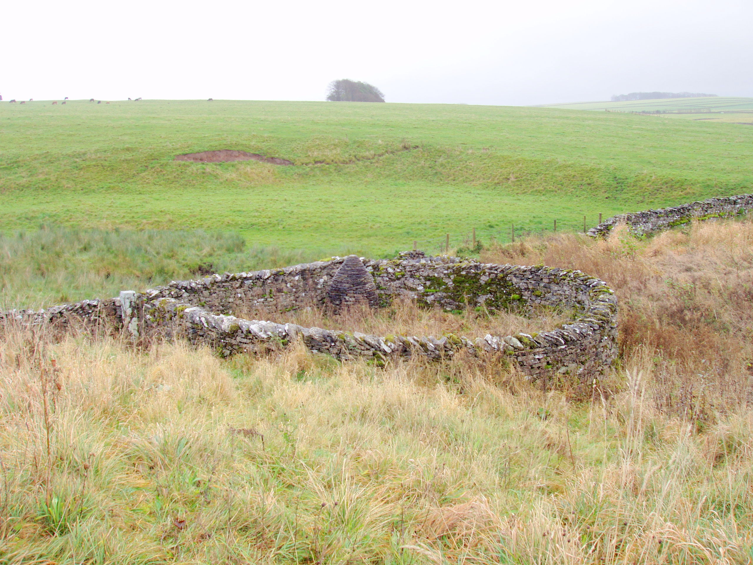
Stockdale Moor (Kinniside) Mountain Pinfold. Grid ref: 309078,509013.
This is an example of a sheepfold on open moor being used as a pinfold. It is on the edge of Stockdale Moor, now stands only in outline but it is possible to identify the three cells forming this Mountain or Moughton pinfold so called because it was used to impound animals from the high moor. Its purpose was similar to that of the usual pinfold in that it was used to impound animals that were found on the moor during the twice yearly drive in order to collect the pinding charge. This rate was 12d for a work horse, 18d for a young horse, 12d for an ox or cow and 2s6d for every 20 sheep. Stockdale Moor was an extensive private agistment ground which provided summer grazing for 1000 sheep and 100 horses from the coastal lands to the west of the moor.
Strands Pinfold, Millom. Grid ref: 318385,484228.
Shown on the 1867 1;10,560 OS map but today is marked by 2 small standing stones. Local information indicated that was demolished prior to 1930. It is noted on the Common Land Register number 491.
Sunderland Pinfold. Not found. A Hand written manor court document dated 1361, held at Cumbria Archives, states “Sunderland Pundfold is presented for being out of repair”. Its site could not be found.
Threapland Pinfold, Aspatria. Grid ref: 315700,539300. This is an ancient hedged pinfold approximately 20mtrs square with access at one corner. The hedge is growing on the top of a small bank which was probably originally strengthened by stones. A modern gate has been placed at the entrance and overall it is in good condition with the interior and surrounding area of grass well kept. Because of its nature it is unusual to find a hedged pinfold still in existence. Its position in the centre of the village at the entrance to a farm makes it a focal point on what may be a village green. On the First Edition County Series Ordnance Survey map of 1868 it is not named but is clearly shown in outline. The centre of Threapland is shown as a semi open area around Threapland Hall.
Threlkeld. The site for this pinfold could not be traced although without doubt there was a pinfold in Threlkeld. It is mentioned in the history booklet in the church and in document PC/21/2-3 dated 1801 held in Carlisle Archives. The sheepfold shown to the south east of the village, on the edge of the fell before enclosure, is a possible site shown on the 1862 OS map but not on the later 1899 one and no trace of the sheepfold can now be found.
Torpenhow Pinfold, Aspatria. Grid ref: 320334,539704.
Pinfold shown at the side of the road next to the school on the 1867 1:2,500 OS map. The area now has modern housing on the site.
Troutbeck Pinfold, Ambleside. Grid ref: 340813,502746.
Although this structure has been suggested as a pinfold it is not named on any OS maps. It is next to High Fold Farm, is in the centre of the village and of a compatible size and construction so possibly was the village pinfold. In the Troutbeck Village Guide published in 1999 Margaret Parsons recognises the use of this structure as a “fold” used for the protection of animals. It is currently used as a garden and is no obvious natural water source so I will assume it is a pinfold until told otherwise!
Troutbeck – Town Head Pinfold. Grid ref: 341671,503928.
This pinfold is shown on the 1860 OS 1:2,500 map. Although only the outline can be seen in the tumbled down walls of this pinfold it was once a significant pinfold in the life of the people of the Troutbeck valley. It is located just off the coaching route to Kirkstone Pass and alongside the Ing Track coming in from the high fells to the fertile and highly prized grazing in the valley.
Ulverston Pound. Grid ref: 328563,478741
A small pinfold much altered from its original shape and size and was used as child’s playground but now locked. It is shown on the Ulverston Town Plan map of 1890 and was Grade II listed in June 1972. It was then described as “Possibly early C19 with later alterations. Mixed stone rubble. Roughly semi-circular on plan with straight side to the north and with walls approx. 1.5-2m high. The curved walls mostly have triangular copings. The straight wall steps upwards at its eastern end where a small building has been demolished. The entrance gateway, at the south-west side, has a stone lintel.” It is believed to be the responsibility of South Lakeland District Council.
Warcop Pinfold, Appleby-in-Westmorland. Grid ref: 375002,515352
Clearly shown on the 1859 1:2,500 OS map but not named as a pinfold. Prior to the rebuild there were only a few stones on the site. The rebuild is by Andy Goldsworthy, as part of the five year public art, landscape and environment commission, managed and developed by Cumbria County Council (1996-2002). It is one of a series of 6 “Cone Pinfolds” where a stone cone has been constructed in the centre of the fold as a public artwork.
Watendlath. Grid ref: 327634,516352.
A reference held in Carlisle Archives relates to the Manor of Borrowdale (D LAW/1/176) dated 1875 stating that John Cannon and Fletcher Wren had fields including a “Green and Pinfold”. This is likely to refer to the circular structure named as a sheepfold on the 1867 OS 1:10,560 map. It is close to the hamlet of Watendlath beside a small beck feeding Watendlath Tarn.
Watermillock Pound. Grid ref:343124,523168
What remains of this pound may be viewed from the bridge as it stands on private land. There is one wall left, but may be more remains in the undergrowth. It was probably robbed during road and bridge improvements. It is named on the 1864 1:2,500 OS map and although its current location seems unlikely for a pinfold there was probably a ford or lower level river crossing originally at this point.
Wigton Pinfold. Grid ref: 325594,547841.
The original pinfold is shown on the 1864 1:500 Town Plan for Wigton at the junction of Low Moor Road and South End road, roads coming in from the moor. It was demolished probably in the 1950’s when the junction was improved. The Evening Mail reported on 29th May 2009 that Anthony Gormley had at last rebuilt the pinfold as part of the arts project launched in 1996 – 13 years after the main event.
Winton Pinfold. Grid ref: 378800,510560.
A well maintained circular pinfold is to the eastern outskirts of Winton on the edge of Winton Common known as Hunger Rigg. It is shown on the 1859 1:2,500 OS map and registered on the Cumbria Sites and Monuments register number 1779.
Workington Pinfold. Grid ref: 300550,528330.
A square pinfold is shown on the 1867 OS 1:10,560 map and it stands in open pasture. The will of Mary Wilson (YDX473/1/2/1) dated 25th June 1805 held in Workington Archives leaves “various properties situate near the pinfold in Uppergate” to her daughter Catharine Wilson. Today it has been replaced by a row of Victorian terraced houses.
End